Interactive GIS Map
Category: UI / UX
Role: UI/UX Designer
Year: 2017
Technology: Adobe Illustrator
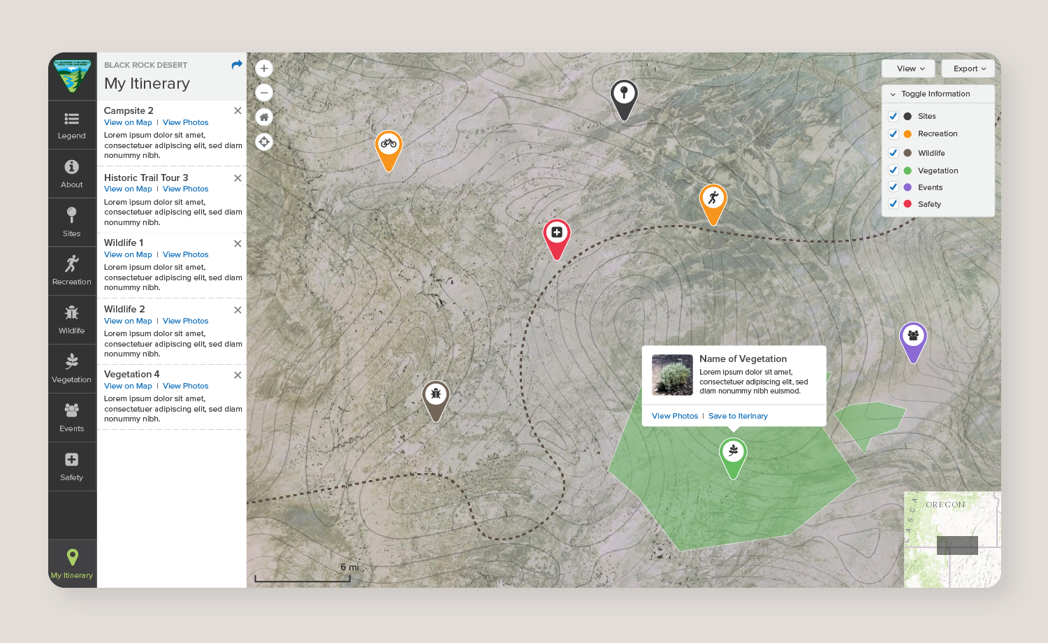
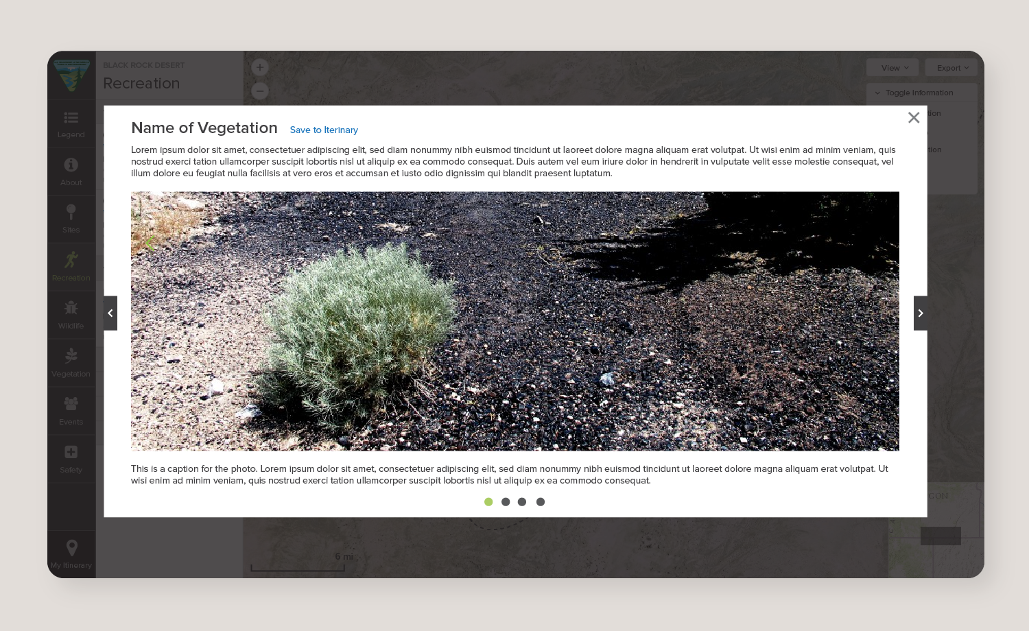
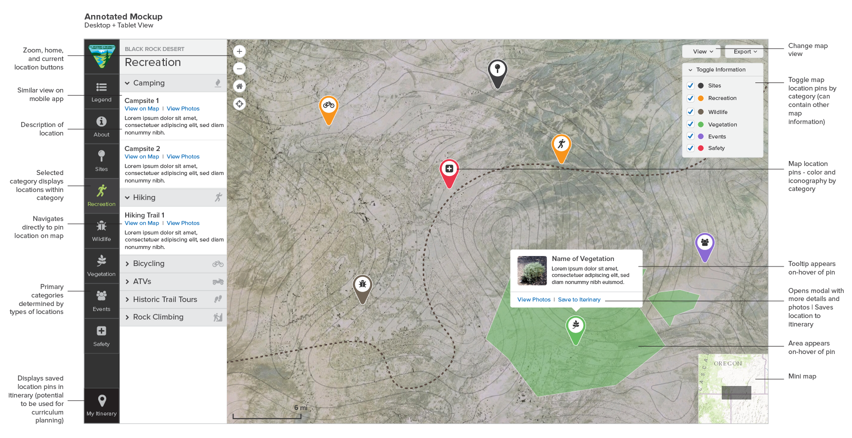
Concept for an interactive GIS map application that allows the user to view a map and plan their itinerary based on categorized sites and points of interest.
Mockups
Created in Adobe Illustrator